")
Drone's Services
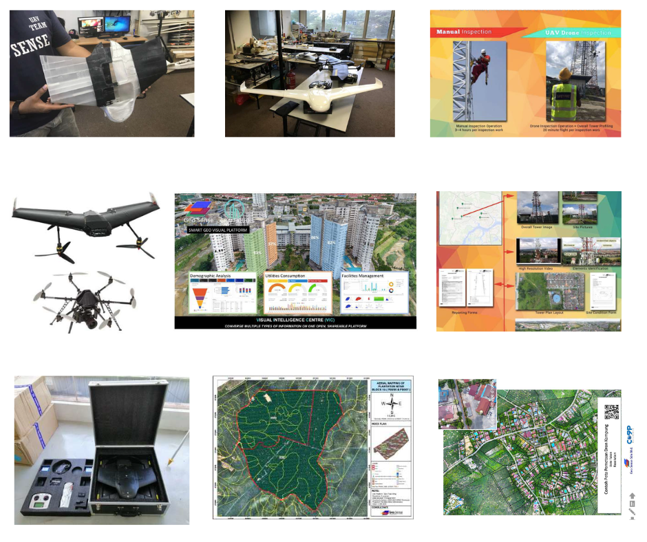
Drone Services & Aerial Surveying
Over 5,000 certified flight hours by professional operators , Large-area drone mapping (coverage of 100 km² in 3 days), High-resolution imaging and video surveys , Specialized in urban, agricultural, forest, utility, and construction mapping.
01
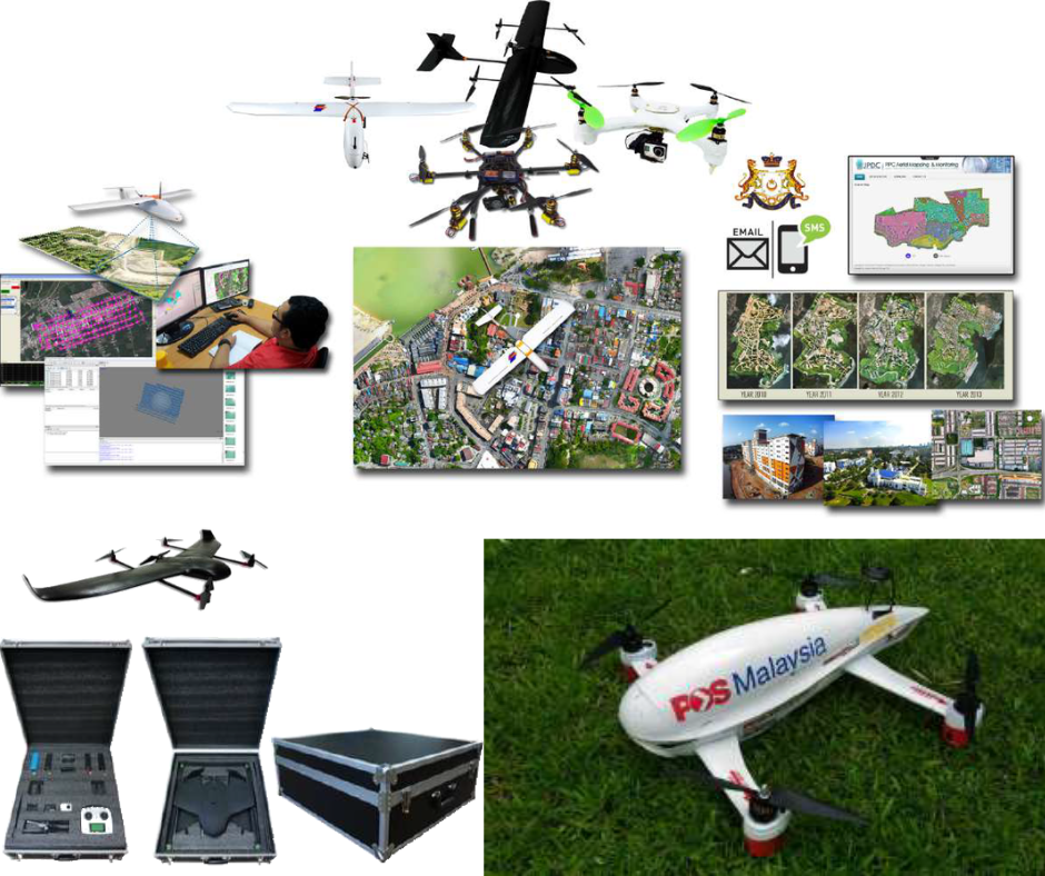
Drone Design, Development & Commercialization
Developer of G-Wing VTOL professional mapping drone , Autonomous Drone Station (ADS) with battery charging and swapping features , Ongoing R&D collaborations with global drone innovation centers.
02
GIS & Geo-Analytics Platforms
Custom geo-mapping and visualization systems , 3D city models and digital asset management platforms , AI-based tree counting and agricultural analytics , Smart forest and property management systems.
03
Training & Certification
Certified programs in drone operation and automation , Academic partnerships for UAV technology training and certification.
04
Smart Farming & Agricultural Technology
Smart poultry systems integrated with IoT and automation , Drone and sensor-based farm monitoring solutions , Advanced agricultural data platforms for health and productivity analysis.
05
Renewable Energy Pilot Projects
Low wind-speed turbine development with university partnerships , Smart farm projects powered by green energy solutions.
06